Hike Leader: Corey Norman
Date: 01-25-20
Hike Distance: ~7 Miles
Elevation Gain: ~3500 feet
It’s the inaugural NMMC challenge blog post! And much like the inaugural hike of the club, back in 1952, this hike visits the Ladrones Benchmark, the highpoint in the Sierra Ladrones. This highpoint is #14 on our Peak Prominence Challenge. We did a loop hike, traveling up the northwest ridge to the summit, south along the summit ridge, then west along a lower and less dramatic ridge back to the cars.
With much of the group coming from different regions, we convened near the new bridge off the Highway 60 East exit. After condensing our caravan, we continued to the parking lot at the end of a rough road on the west side of the mountain. From the parking spot we began our hike by passing through a gate on a bit of a trail but immediately then turned off trail toward a drainage to the north/northeast. We hiked up the drainage along the mostly frozen ground, shedding layers quickly as we started gaining elevation. Not long after starting, we began hiking very steeply uphill to the first prominent peak on the northwest ridge, requiring pretty frequent breathing breaks for the group.
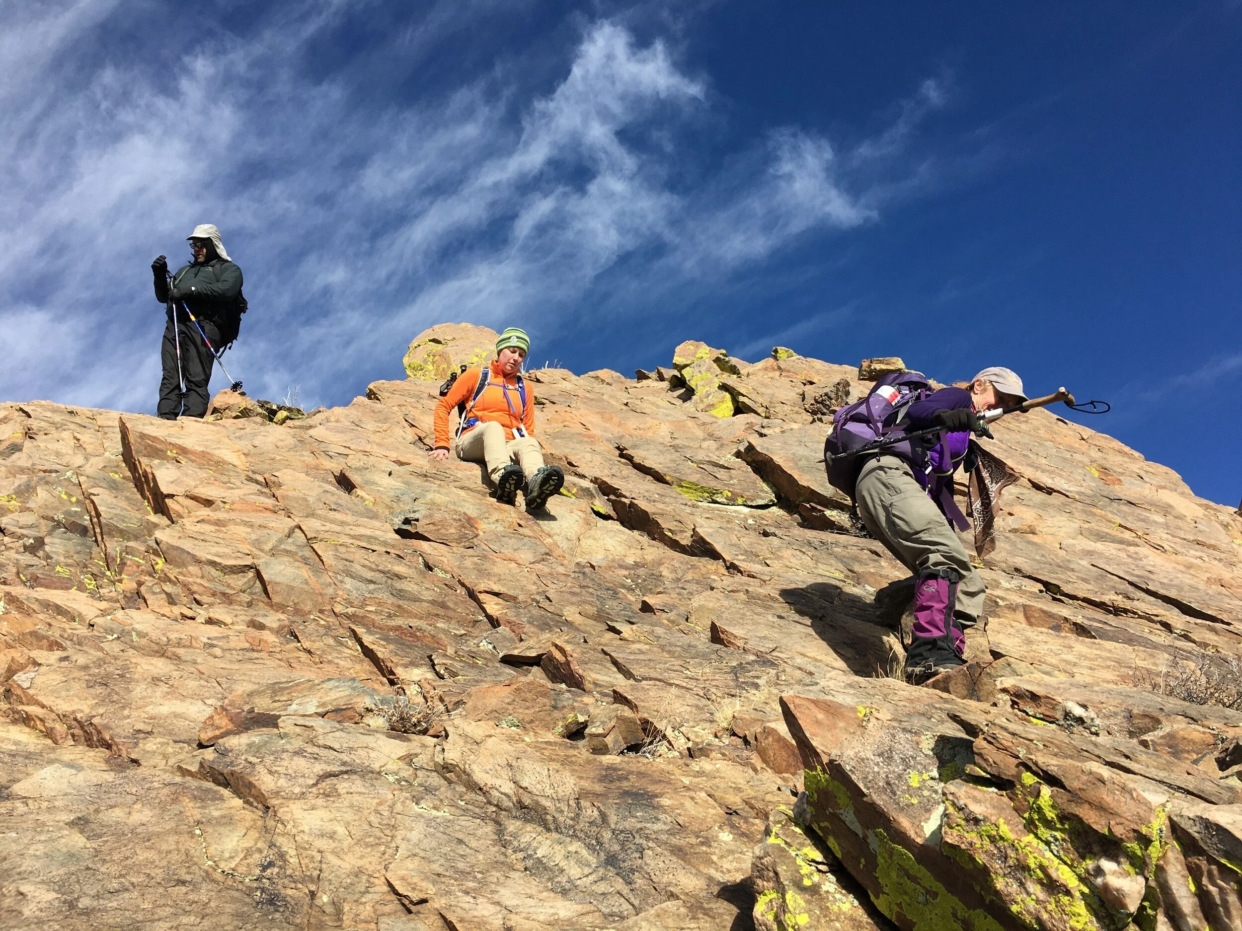
Once at this first peak, we followed the ridge the rest of the way to the summit. The lower half is relatively uneventful, save for some extra unnecessary scrambling we did for fun. However, the higher the ridge climbs, the rockier and narrower it becomes. We did some minor scrambling until reaching the first prominent buttress along the ridge. There are many similar buttresses as you gain elevation, but there is always a way through or around them. This first one had a gully going up its south side full of pretty solid blocks that made for some fun scrambling, depositing us up onto the top of a beautiful slab. From here we kept climbing upward until reaching another buttress that looks impassable from a distance. Upon closer visitation, there is a gully on the northeast side of the smaller formation that climbs up to connect to another gully on the south side of the larger formation. On a previous visit this was a nearly trivial section of the route, but today it was the crux. The lower gully was full of 6+ inches of powdery snow, but it allowed for us to find our footing in the talus beneath the snow. At the top of this steepening gully, we reached the second one which was steeper than the first, but had better snow and some rock scrambling. This part challenged some in our group significantly.
After a short break at the top of this difficult section, we continued onward. The obstacles became increasingly rocky and narrow, with some scrambling with exposure. Another crux had two options: one was a 15 foot climb up some vertical rock, and another less vertical option that was made trickier by the presence of snow. The group did both about 50/50. Just above this was the one most narrow spot on the ridge, walking along a ledge. Following this airy section was the last real trick of the ridge, with two options once more: an easy but exposed scramble out left, or a less exposed but more technically challenging corner to the right. Again, some did one and some did the other. Just after this scramble, we were at the summit!
After tagging this high point and signing the summit register, we had lunch on the east side of the summit ridge, out of the wind. Once it started getting a little too chilly, we packed up and headed south along this summit ridge. We continued this, going up and down a few peaks along the way, until we reached a final buttress at the end of the high ridge. The terminal buttress if you will. This buttress is impassable down its south face by all but those with a rope, so we took a gully (from a northern notch on the buttress) down to the west side which provided one last major scrambling obstacle through and down a notch. Once we were all safely through this, we headed down to a saddle below this buttress, mostly doing relatively mellow hiking with some loose talus thrown in for good measure. From here we traversed a snowy hillside toward another saddle. The original plan was to tag the peaks above the second saddle, but we were running a little low on time for that. After a second food break at this last saddle, we then headed west down the last ridge for some easy hiking back to the cars, closing the loop we hiked. We arrived just after the sun set behind the Gallinas Mountains to the west.
After the hour long drive back to pavement, we split ways, some getting food, and all made it home safe and sound! The Ladrones Benchmark is now crossed off the peak prominence challenge!
-Corey Norman