As previously stated, one of our challenges this year will be to summit all of the New Mexico peaks with a prominence greater than 2,500 feet. We will be using information from Peakbagger.com to guide this challenge. Using the list from Peakbagger.com, there are 26 peaks in the state with such prominence. Four of those on the list are on private land, and therefore not applicable to the challenge. This leaves us with 22 peaks spanning from the region near the Colorado border to the bootheel near the Mexican border.
I know some folks are asking, what is peak prominence? In the most broad and basic ways to describe it, prominence is essentially a number denoting how high a peak rises above its surrounding terrain. To more technically describe it, we’ll quote Peakbagger.com “Prominence is the vertical distance a given summit rises above the lowest col connecting it to a higher summit. To calculate it, you must know the elevation of a summit and the elevation of its key col. A problem arises when one or both of these elevations are not known precisely. Most commonly, col elevations are not given on topographic maps, so all that is known is a range based on a contour interval. Many summits also are represented by just a closed contour and no exact elevation.”
There are multiple methods used to determine peak prominence. We will use the “Average” method, explained by example here: “Imagine Peak X, located on a map with 40-foot contours, and having a summit elevation between 3960 and 4000 feet, and a key col for prominence between 2920 and 2960 feet. We split the difference between the contours at the summit and the saddle. The elevation of Peak X is set to 3980 (3960 + 20, which is half the contour interval), the key col is 2940 feet (2960 – 20), and the prominence is 1040 feet. This method is most likely to be closest to the real numbers, but the numbers will be overstated or understated in a random pattern.”
Now, with all of the introductory stuff out of the way, below is the list of peaks we’ll be attempting this year! I’ve provided a brief description of location and basic terrain.
Chicoma Mountain (4,291 ft.) – With an elevation of 11,561 feet, Chicoma Mountain is the high point of the Jemez Mountains. The region is characterized by both open green meadows and heavily forested slopes. There is a long and bumpy road that goes up near its summit, but the nearby Polvadera Peak means you can make a legitimate hike by bagging the two. Chicoma has a shrine on its summit and spectacular views in all directions of other familiar peaks and mesas.
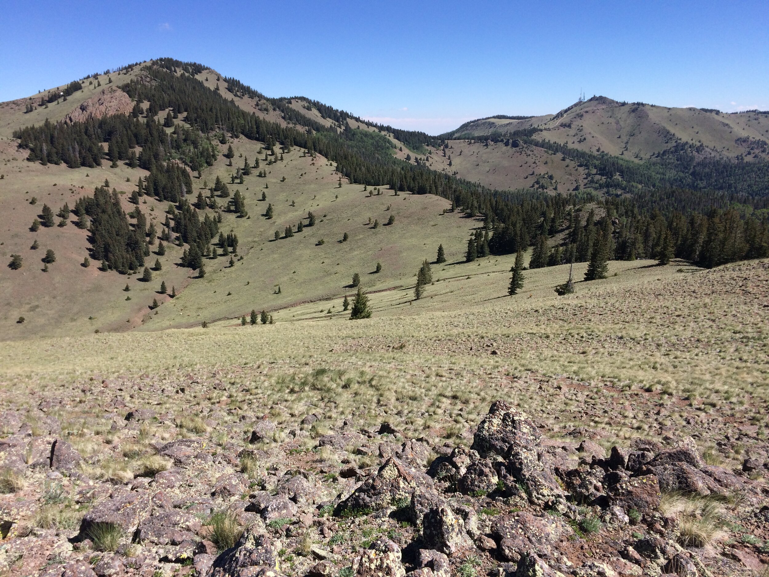
Sandia Crest (4,108) – With an elevation of 10,678 feet, the Sandia Crest is the high point of the Sandia Mountains, even though it has few of the more thought of peak-like qualities. Hiking up from the west side would mean going through a wide range of life-zones along your hike, hiking up from the east side generally through forest. There is a road going all the way up to this point, but there are several trail options to hike up to claim this point.
Mount Taylor (4,094) – With an elevation of 11,301 feet, Mount Taylor is the highest point for many miles in any direction, which means the views from the summit are spectacular. The northern slopes here are thickly forested while just south and east of the summit are wide open meadows, giving you the feel of hiking a higher peak above treeline. There are a number of ways to reach this summit, the Gooseberry Spring trail being the most popular.
Truchas Peak (4,001) – With an elevation of 13,102 ft., Truchas Peak is the second highest peak in the state. It is also one of the most difficult to reach, many options long enough to inspire a backpack. This peak is high above treeline in craggy terrain and you may easily find yourself doing some exposed scrambling if bagging nearby peaks as well. Read The Trip Report
South Baldy (3,813) – Sitting at 10,783 feet, South Baldy is the high point of the Magdalena Mountains, west of Socorro. There is a ridgeline connecting North and South Baldy which provides a pleasant and generally treeless hike. There are great views of the deserts out east, the Ladron Mountains to the north, and the San Mateo Mountains to the south and west. Again, there is a road going up toward the summit, but many trail options exist as well.
Organ Needle (3,730) – Sitting at 8,990 feet, the Organ Needle is the very rocky high point at the southern end of the publicly accessible Organ Mountains. Getting here requires hiking through some rough desert vegetation through very steep terrain, and the summit is guarded by a short section of 4th Class scrambling.
Big Hatchet Peak (3,706) – Sitting at 8,356 feet, the high point of the Big Hatchet Mountains near the Mexican Border is one of the more seldom-visited peaks. These desert mountains rise abruptly from the surrounding relatively flat terrain. Aside from a single road that goes up to some towers on the summit, no official trails penetrate these mountains. However, options abound in regards to routes.
Whitewater Baldy (3,545) – Sitting at 10,895 feet, Whitewater Baldy is the high point of the Mogollon Mountains on the edge of the Gila Wilderness. This peak can be visited as a dayhike or as part of a backpack loop. One of the trails that came up from near the Catwalk by Glenwood is no longer existent as a result of the Whitewater Baldy Complex fire several years ago, but other options exist, especially coming in from the north.
Wheeler Peak (3,409) – At 13,161 feet, this is the high point of the New Mexico. High above treeline, this peak provides wide open views in all directions of other high peaks in the northern mountains. The most popular route is likely via the trail from near Williams Lake, which zig zags its way up through the forest out into the tundra landscape. Numerous other route options exist depending on what sort of hiking experience you’re seeking.
Capitan Mountains Highpoint (3,271) – At 10,201, this is the high point in the Capitan Mountains, a rare east-west trending range down near Carrizozo. These mountains are the home of Smokey The Bear, and naturally you will likely hike through burns from forest fires. A steep trail ascends the northern side of the mountains to the top, and a 4WD road climbs to the ridge from the west, but otherwise there are few trails in this range that will take you to the summit.
Manzano Peak (3,248) – At 10,098 feet, this peak in the Manzano Mountains sits near the southern end of the range. Trails from the east climb through forest while from the south they climb through forest and burn and up through some scrubby terrain. There are multiple trails and loops possible that will take you to this peak, some of which have been affected by wildfire burns over the years.
Florida Peak North (3,215) – Sitting at 7,460 feet, this high point was once thought to be slightly lower than Florida Peak South. Different methods of measurement have since shown this to be the higher of the two. The very rocky Florida Mountains lie just south of Deming in southwestern New Mexico, providing the only home in the state for the non-native Ibex, which do well in these typically forbidding terrains. This high point is guarded by a section of 4th Class scrambling, steep and exposed enough to warrant a rappel anchor on the summit for some, though some folks do just downclimb. (Trip Report for Attempt)
West Blue Mountain (3,146) – Sitting at 10,336 feet, this is the high point of the large San Mateo Mountains, southwest of Socorro. Not to be confused with the San Mateo Mountains that Mount Taylor is a part of, these mountains comprise some of the least visited terrain in the state. West Blue Mountain can be done as a long dayhike, though backpacking options abound. Most of the trails reaching near this summit travel through heavily forested terrain. Multiple trails come near the summit, but I believe some bushwhacking is in order to attain the summit proper.
Ladrones Benchmark (3,140) (COMPLETED) – Sitting at 9,210, the Ladrones Benchmark is the highpoint in the Ladrones Mountains, slightly higher than the named Ladrones Peak just to the east. There are multiple routes to this summit, though scrambling and scree are usually the name of the game. Due to its position as the highest point for a number of miles in any direction, this is another peak where wonderful 360 degree views are the reward for summiting. This peak is actually along the route of the first hike ever done by the New Mexico Mountain Club back in 1952.
Venado Peak (2,971) – Sitting at 12,734 feet, this peak lies deep in the Latir Wilderness, far enough to warrant either a long day hike or a backpacking trip. High above treeline, you’ll gain great views of the surrounding mountains, including northward into terrain that is not publicly accessible. There are many other peaks in the vicinity for the motivated peakbagger looking to make the most of their trip.
Mount Phillips (2,921) – Sitting at 11,741 feet, Mount Phillips is in the northern mountains within Cimarron Canyon State Park, along the boundary shared with the Philmont Scout Ranch. Some study of maps is required to make sure there is no trespassing onto the Ranch en route. There are no trails that take you to this summit, so bushwhacking will likely be on the menu for those wishing to bag this one. Nearby creeks and game trails may provide some sort of travel routes to get close.
Timber Mountain (2,820) – Sitting at 7,565 feet, Timber Mountain lies at the heart of the Caballo Mountains, overlooking Caballo Reservoir down to the west. This is another one where a road drives up to the summit, but many options exist for off trail routes. Limestone cliff bands claim much of the western faces of the range, so routefinding is particularly important if coming from this side.
Baldy Mountain (2,701) – Sitting at 12,441 feet, Baldy Mountain lies in the northern mountains in a manner similar to Mount Phillips in that it straddles the border of Cimarron Canyon State Park and the Philmont Scout Ranch. Combined with other nearby peaks like “Touch-Me-Not”, a productive mostly off trail hike will get you here from the south. There are no official trails going near Baldy Mountain, though I have read there is an unofficial trail that has been created en route to the summit of Touch-Me-Not.
Carrizo Peak (2,655) – Sitting at 9,605 feet, Carrizo Peak is another desert mountain (though more forested than a typical desert mountain) west of the Capitan Mountains, north of Carrizozo. There is a trail that goes all the way to the summit, though it seems it is not always obvious to see. Prepare for steep hiking and views to the south into the Tularosa Basin, as well as the backside of the off-limits Oscura Range.
Cookes Peak (2,588) (COMPLETED)– Sitting at 8,408 feet, Cookes Peak is a very noticeable peak, discernable from Interstate 10 and even parts of Interstate 25. This is a rough desert peak, with typically harsh desert vegetation to contend with, as well as some scrambling to attain the summit. In addition to the peak, there is some very interesting history to visit in the area, remnants from a violent past. Read The Trip Report
McKnight Mountain (2,545) – Sitting at 10,165 feet, McKnight Mountain lies along the crest of the lightly-visited Black Range near southern New Mexico, surrounded by the Aldo Leopold Wilderness. There is a rough road that goes all the way up to McKnight Cabin, providing a trailhead that will take you to McKnight Mountain. Many other options exist as well.
Cerro Vista (2,519) – Sitting at 11,939 feet, Cerro Vista is the highpoint along a wide ridgeline in the Sangre De Cristos of northern New Mexico. There are higher peaks in the region, though with less prominence. A rough road drives almost all the way up to Cerro Olla, southwest along the ridgeline.
And that is all the peaks within our challenge! Good luck to all of the leaders planning to visit these high points and to all of the Mountain Clubbers that plan to join you! I look forward to hearing of your attempts, hopefully mostly successful! We’ll keep you all up to date on here as these peaks start getting ticked off the list.
See you out on the trails or out in the brush!